Wapakoneta, Ohio
Aerial View From 1000 Feet
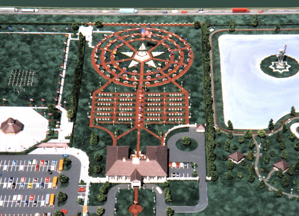
Proposed location is at I-75 Exit 111, Wapakoneta Ohio. North of the Neil Armstrong Air & Space Museum
For your viewing pleasure we have included this aerial view of the Freedom Field Project, which is a 30 acre park. For reference, the three circles in the upper center are portions of Freedom Walk with the outer circle measuring more than 300 feet across. Below the circles is the Field of Honor and below that is Republic Hall (see links for descriptions). The pictures you will see on the pages listed under the ‘Project’ navigation tab are actual photographs of the scale model of Freedom Field Project Park and Museum. The project was conceived by David Christiansen and the model was designed and built by Larry McLean, both of Wapakoneta, Ohio. The model project took Larry more than 700 hours to complete and is available for viewing and presentations to clubs and organizations, companies and corporations. We invite you to contact the Project for more information and details about the project.